As I put my foot down on the steep, dusty, pebble covered slope, my foot slipped from under me for the 14th time.
$^&* I thought. Or said out loud.
Even with trekking poles and pretty good balance, I find myself sitting down to an unplanned rest as the dirt slides away beneath me. Might as well eat a snickers bar while I’m here.
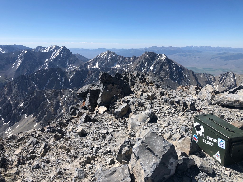
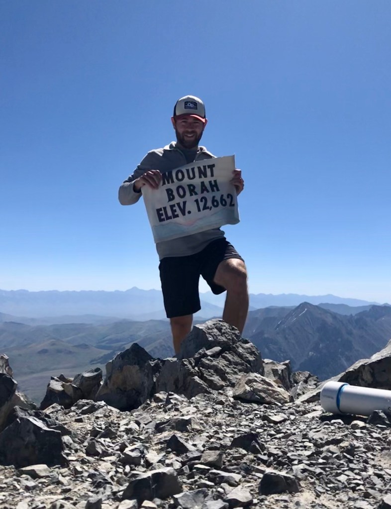
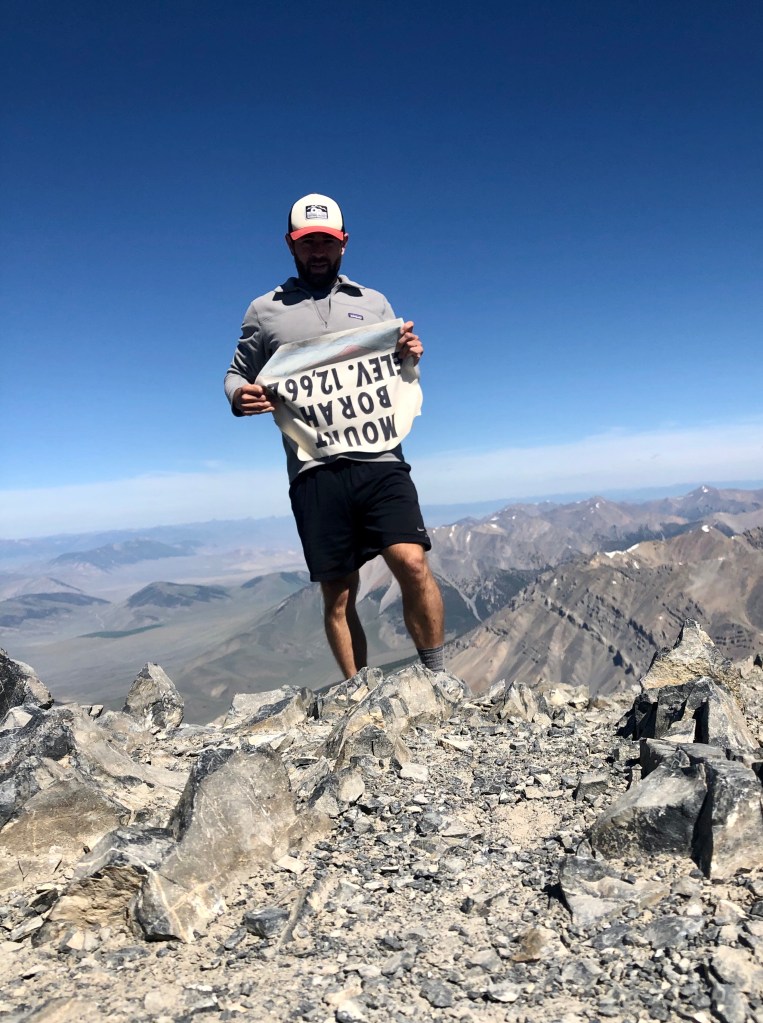
An hour before, I was standing atop Mt. Borah. Or Perhaps Borah Peak? Either way, it stands atop the state of Idaho (where people are less than 50% likely to be wearing masks during a global pandemic) at 12,662 feet.
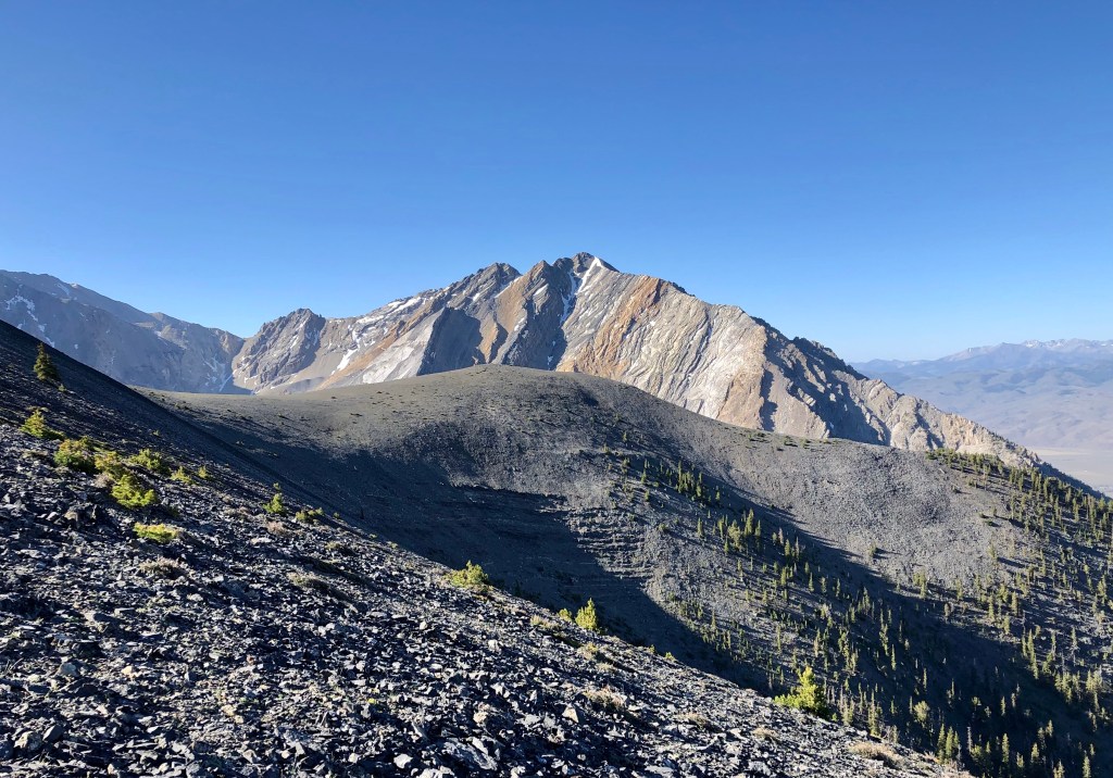
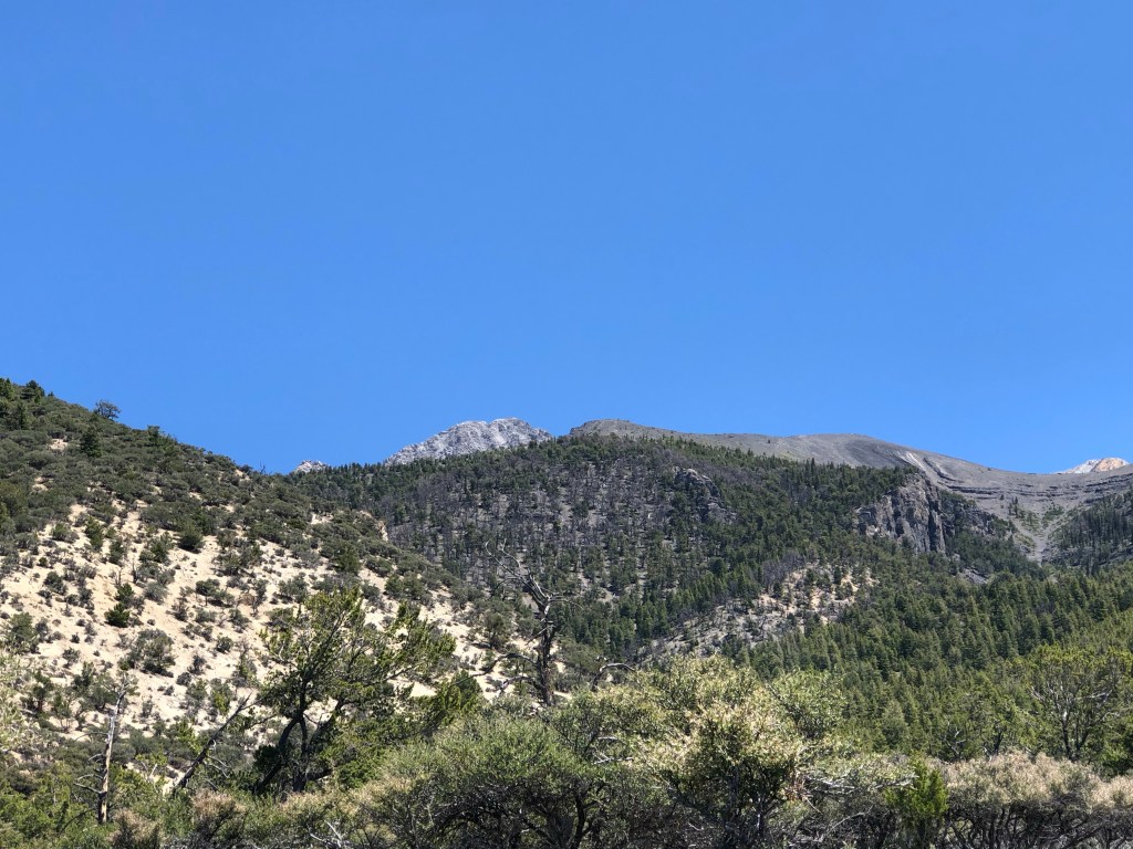
Among the highest points I have visited to date, I would rank Borah as “strenuous”, largely in response to its 5,000+ feet of elevation gain over 4 miles of straight up, steep, loose-over-hard-pack trail. When the mountain consents to make it easier on you, it replaces the steep loose-over-hard with either steep talus and scree, or low-grade scrambling (3+ points of contact while progressing but no ropes needed).
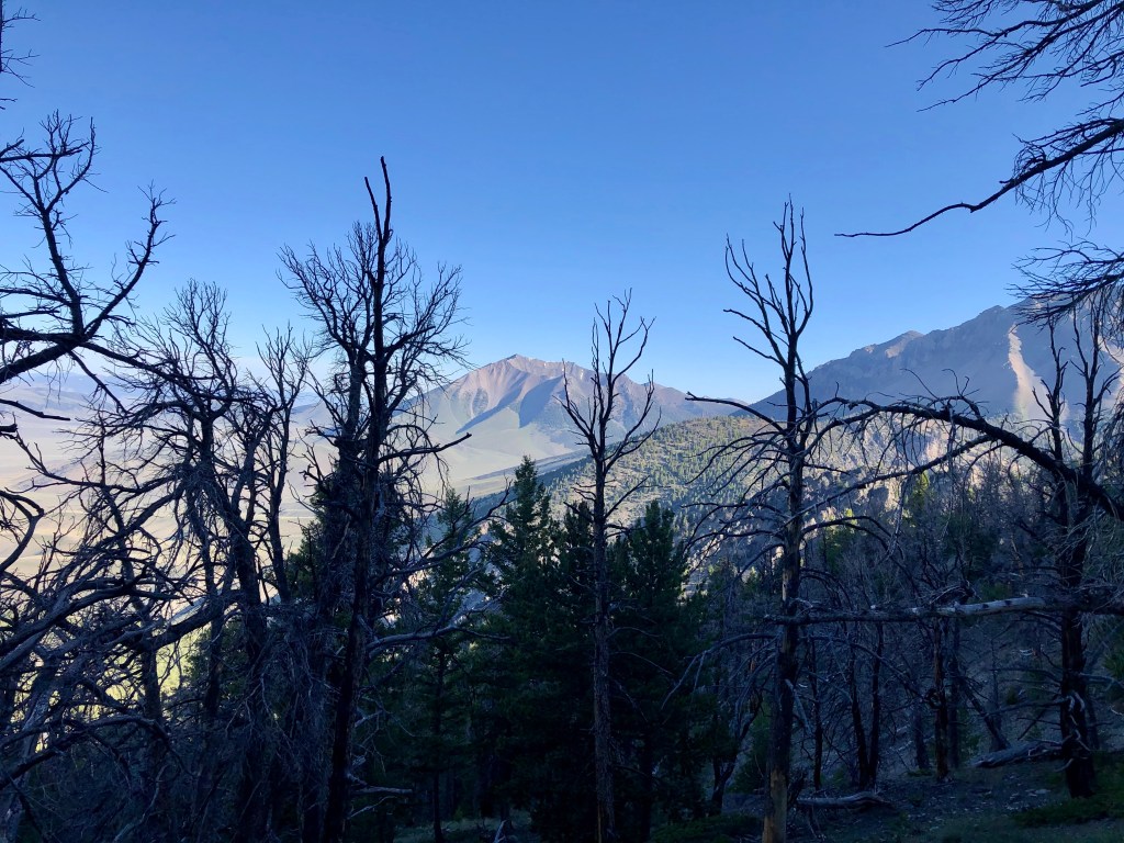
Anytime you’re in the mountains, it’s necessary to be aware of afternoon thunderstorms. While this wasn’t a problem on the particular day I went, I elected to get a moderately early start anyway, and was ready to start hiking around 7:45am.
I’ve had some foot struggles on my last few hikes. Both my pairs of hiking boots caused hotspots or minor blisters on the heel during previous hikes. My “comfortable trail shoes” that I tried at Cascade Pass caused lots of toe pain on the downhill as my toes smashing into the front of shoes. On my hike at Alice Lake, my sandals rubbed my feet raw in a few places from hiking through streams and snow. The latter might be my own fault. I decided to go with familiar running shoes. To end the suspense you are unquestionably experiencing, it was no better. My toes were smashed and I had the start of blisters. It just appears that I have become weak in my late 30’s. Now we return to the trailhead.
I thought the trail was a little steep starting off. It only got steeper as time went on. Up up up. I passed one large group that must have had a very early start.

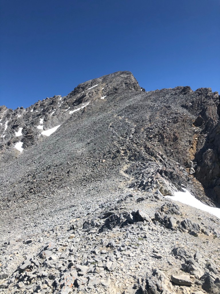
About 90 minutes in (I made that up but it’s close enough) I reached the famous, infamous, chickenout ridge. Why is it so named? Well, simply journey to its start and observe your fellow hikers. I met two guys who got a 4:30am start (yikes! what were they doing all this time?) only to turn around at the ridge due to the exposure. Okay, I admire their decision to turn back. It’s the smart thing to do. I just wanted to poke a little fun. For those interested in a lecture, and those who are not, always stick within your abilities and degree of comfort with terrain in the mountains. The mountain will always be there. When you fall, you will not be. Anyway, as a former intermediate level rock climber, I felt extremely comfortable with the exposure and the level of skills required to complete the scramble. It was definitely a longer scramble than I expected, but I would say only slightly more challenging than the “knife edge”, which I descended from the top of Mt. Katahdin in Maine
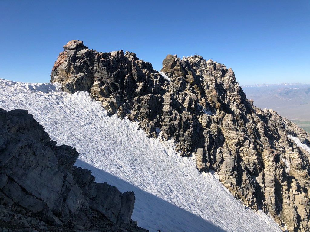
The highest risk in my mind was crossing the “snow bridge” (more of a snow ridge as, technically, a snow bridge crosses over a crevasse and this does not). A slip here would result in a long, snowy runout with lots of “woohoos” and “wipees”, and then a slightly less comfortable tumble into a rock field and eventual doom.

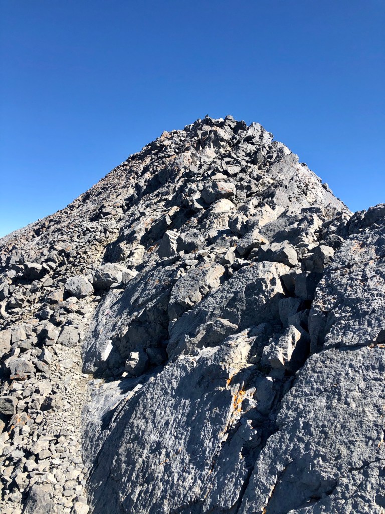
From here, its a pretty straightforward process to route find and scramble your way through the unrelenting talus to the top of the mountain. For those that use this as a guide (stop!) you will want to be careful as most of the rock is loose and even larger pieces are prone to fall upon contact.
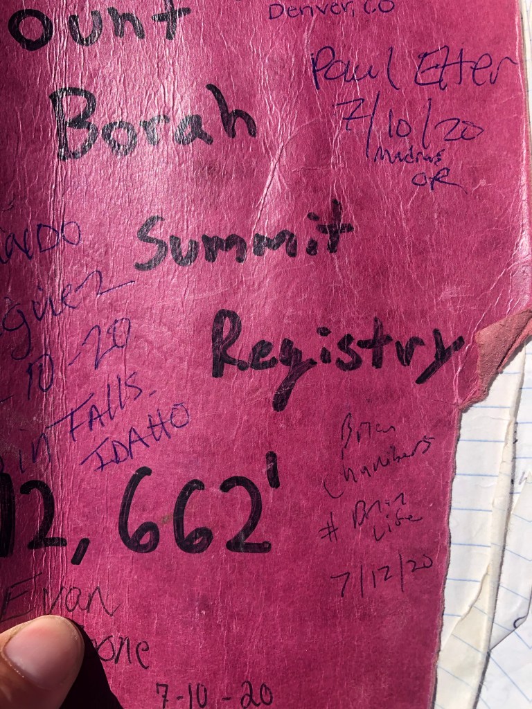
Summit
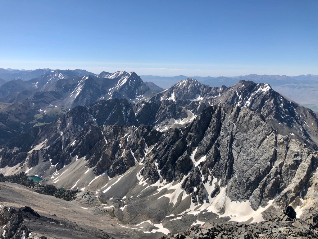
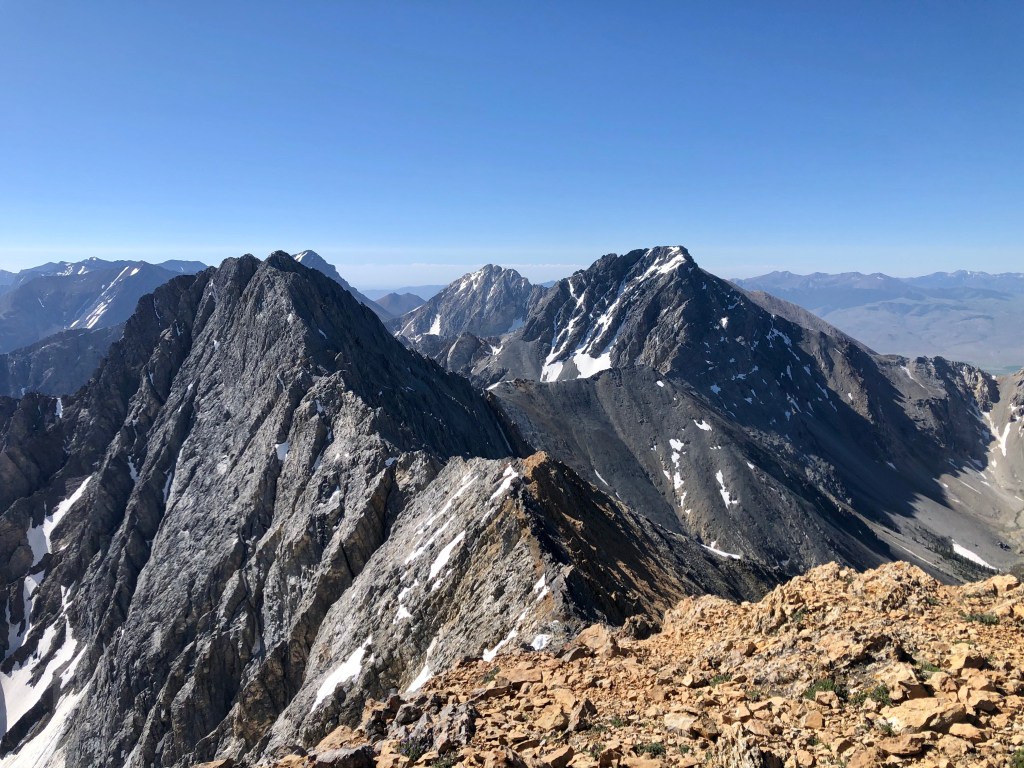
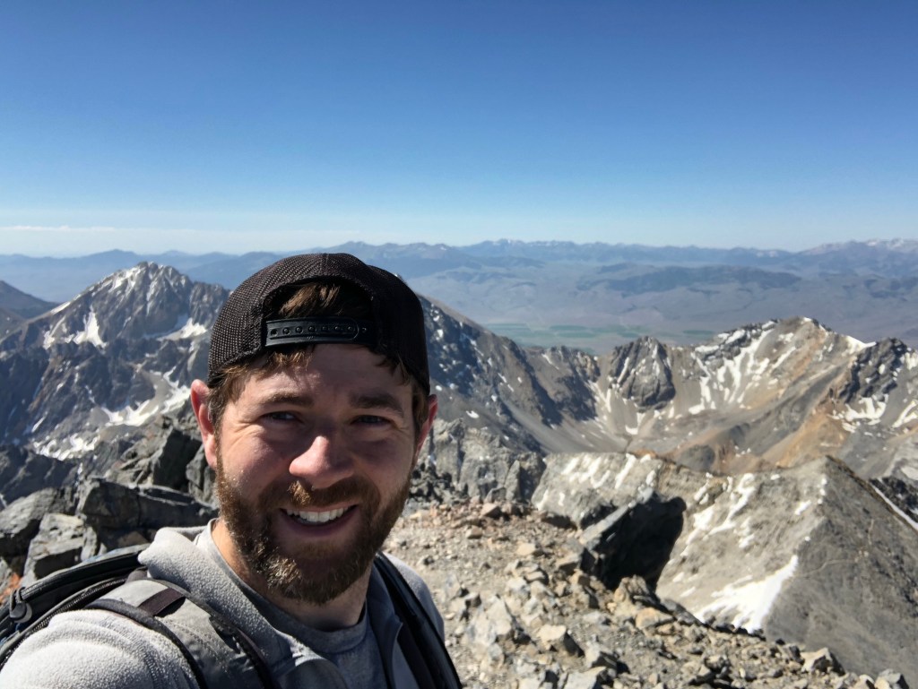
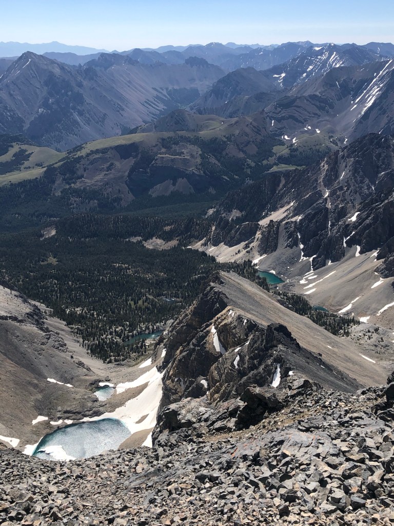
Among summits, I rank Borah very high. The views are fantastic and diverse in every direction, including sun drenched valleys, rolling green and brown hills, alpine lakes shimmering in the sunlight, patches of snow clinging to the surrounding jagged peaks of the sawtooths, and beautiful clear blue skies. Beyond that, some locals were kind enough to add a “summit flag” along with the register at the top. Pretty cool! Thanks to Clint Barg (who messaged me on instagram to say congrats on the peak) for this amazing idea!
Descending
As an addicted mountain biker, I was constantly wondering if it would be possible to ride some of the extremely steep sections. I think the answer is yes, but it would have been a slow speed ride. There would be some great technical moves, so cool root and rock drops, but most likely a lot of crashes. And the scamble sections are unrideable and probably not even possible to carry (a few low grade climbing moves were included in my process). I’d love to try it though.
Descending was terrible. My legs are now built for mountain biking and the descent alone resulted in a solid four days of sore legs. Not to mention countless times where I nearly ended up on my back as my feet attempted to reach for the skies. They are so ambitious, those feet.

However even a painful descent impacting the knees and toes (but not the head or shoulders) with sustained unapologetic impacts is a happy one when the goal of going up has been reached, and I was quite happy to return to the car with Borah in my list of state high point summits. It was a bit toasty as I returned, at least by my “summer-out-west” standards. I finished with my shirt off and got a little much-needed sun.
I would definitely regard this as one of the 5 most fun high points I’ve completed due to 1) the scrambling and route finding and 2) the fantastic views at the top. That said, it’s unlikely I’ll return for another beating… but you never know.
I celebrated my victory with a 1/2 pound burger and beer at Grumpy’s in Ketchum. It was a much different and more alive place by mid-July (I was there in early June for 10 days).
