
Two weeks ago, a teenager passed away after being struck directly by lightning while hiking Humphrey’s Peak. Because temperatures reach such an ungodly height and afternoon storms are so common, I elected to get an early start on Humphrey’s Peak.
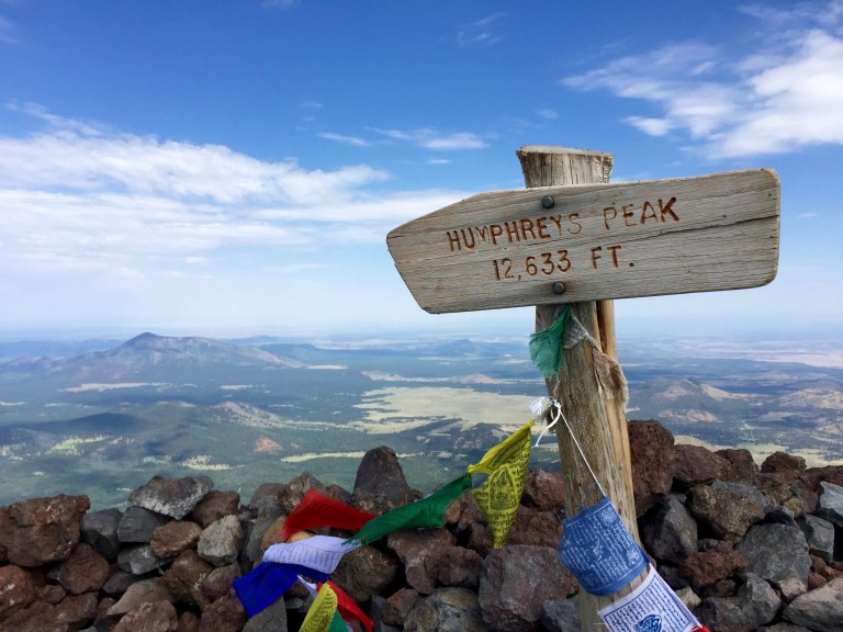
Humphrey’s is the highest point in the state of Arizona. I am attempting it as my 23rd state high point. It sits just north of Flagstaff, overlooking the surrounding (surprisingly green) landscape from a height of 12,633 feet.
My route was to take the standard Humphrey’s Trail from Snowbowl Ski Area up to the summit. The round trip hike is roughly 10 miles (4.8 each way + some wandering around the summit).
I set out at 6:45 AM and headed for the top amidst a few other groups of hikers. The trail starts by literally crossing a bunny slope for the ski resort, complete with chair lifts and all. Those I have graciously avoided in my pictures as judiciously as possible as they don’t make for beautiful photography. I digress…

I was fortunate to have an absolutely beautiful day. The early start alleviated most of the risk of storms, and also rewarded me with some cool weather, for which I am always appreciative. Temperatures were in the mid 60’s at start time, and I even wore long sleeves for about 5 minutes.
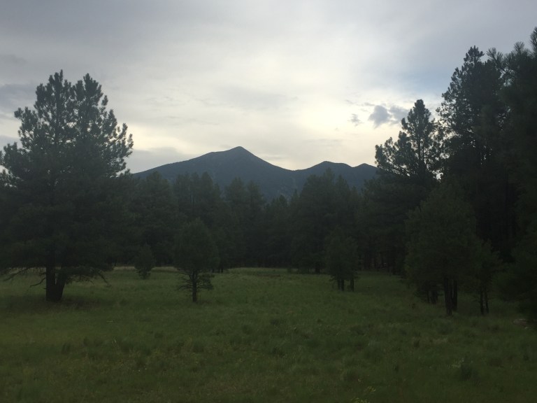
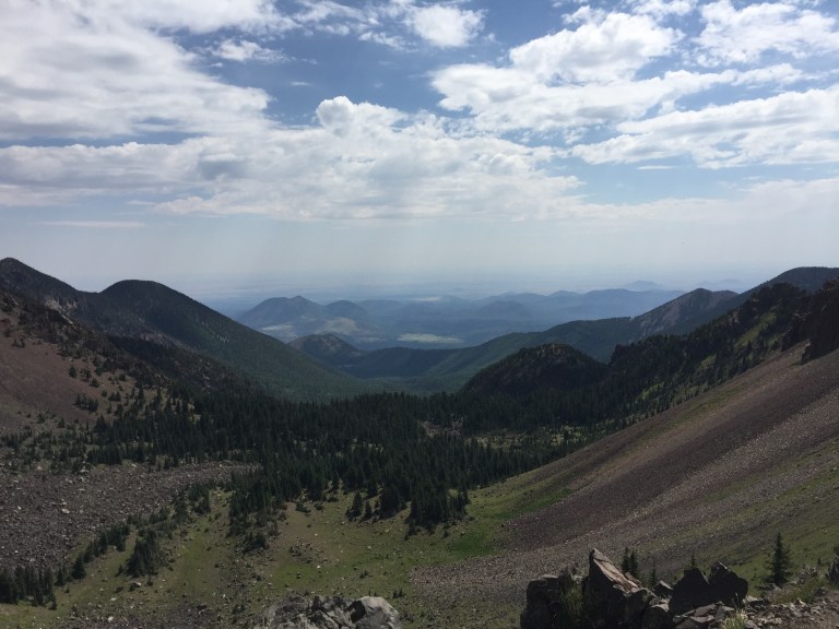
The trail slowly climbs through a beautiful forest as it works to escape the tree line. The trees are predominantly evergreen, which casts a fantastic Christmas-like aroma throughout the forest.
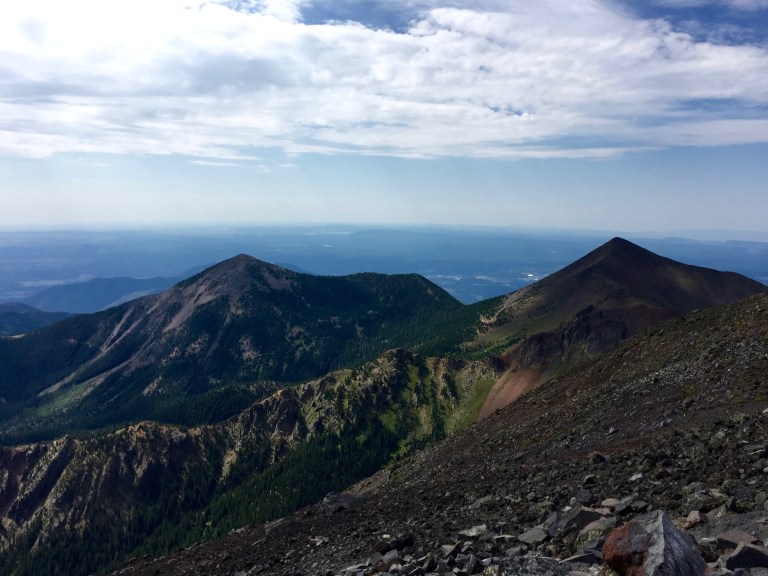
As the climb continues Aggaziz Peak comes into view. I actually thought this was Humphrey’s and send a picture or two to some friends claiming as much. One reply – “that doesn’t look like Arizona”. I agree.
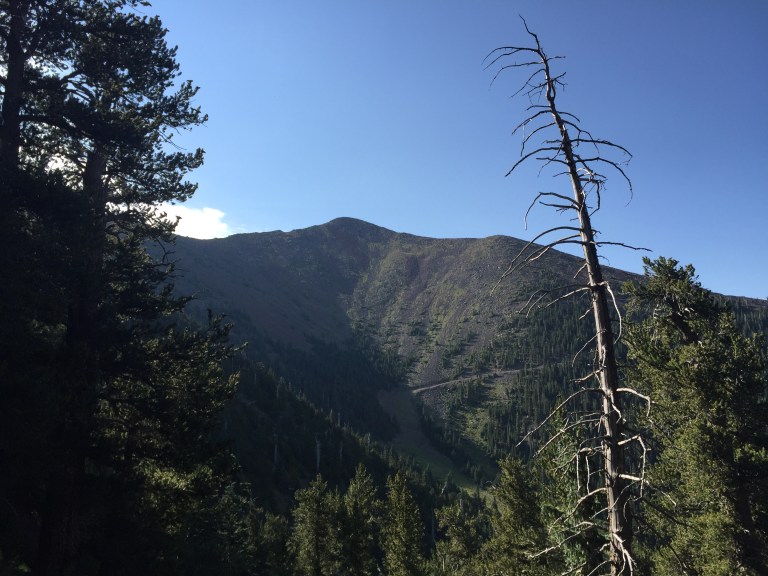
As the climb continued above tree line and the temperature began to rise, the true summit came into view.
From here, the hike reminded me a lot of Knife Edge on Katahdin, minus the occasional scrambling and exposure. Lots of loose rocks. Beautiful.


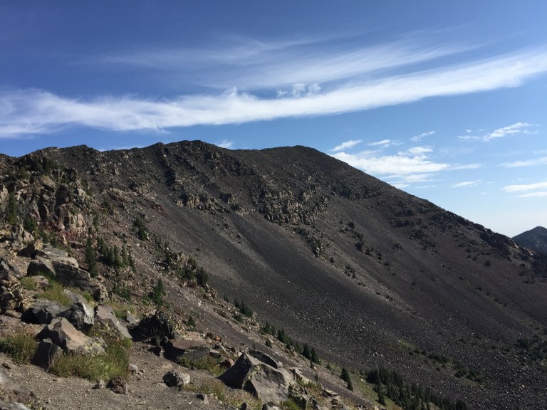
After a quick water and snack break (I didn’t eat before I started for some stupid reason) I pushed up to the top. I felt good, made good time, and didn’t really have any issues with the altitude. I was soon deposited at the top of a rocky slope, the top of which was my goal: the highest reaches of the strangely-exempt-from-daylight-savings-time state of Arizona.


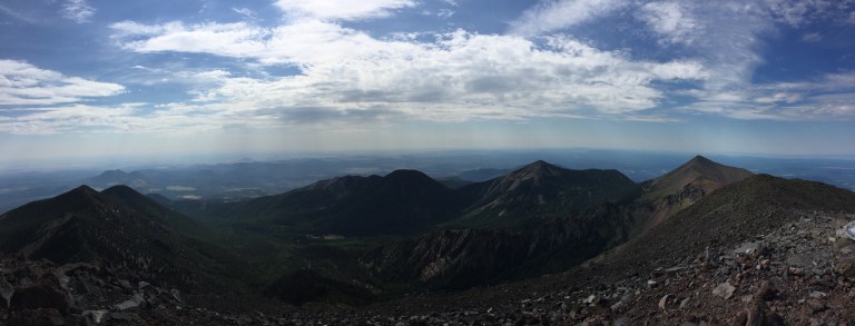
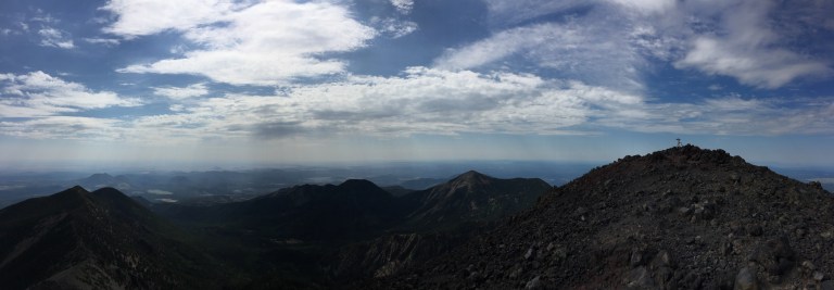
You can see why you definitely would not want to be caught in a storm up here as everything is very exposed to the elements. I spent about 15 minutes on top taking pictures, getting a few sips of water, and searching for a US Geological Survey marker (which I never found).
Right before the last 200 yards of the hike, I ran across an extremely friendly Father/Daughter team from Phoenix (John and Jenna) that were hiking together. They had started at 5:30 and were headed down. I chatted with them briefly about their hike, where I was from, my high-pointing journey, etc.
On my way back down, I ran across them taking a break and they were kind enough to offer me some snacks. Since I am perpetually hungry, I accepted. We spent a few minutes sitting and chatting some more. We were sitting right about here.
We started walking down and winded up chatting the entire remainder of the hike. It was an engaging conversation, discussing everything from Chick-fil-A to business to choosing college majors and “failing fast” to great places to travel.
While the hike was enjoyable and the views were spectacular, spending the time walking with these awesome people was the highlight of my day. Its always a great pleasure to run across good people who are also out enjoying the outdoors. John/Jenna – If you read this, it was fantastic to meet you and thank you for making the trip down so enjoyable.
When we were about 45 minutes from the parking lot (11:15 AM local time), it started to rain lightly and I began to hear claps of thunder in the distance. The anticipated afternoon storm was, indeed, rolling in. There were numerous people still headed towards the top (therefore 2-3 hours behind us at this point), but a quick google news search indicates that – thankfully – everyone seemed to have made it down safely.
I wisely stashed a local Arizona beer in a bag of ice that I gathered from my hotel before leaving that morning, so I relaxed and celebrated peak #23 in the parking lot before the rain rolled in, and I rolled out.
