
Baxter State Park. Mount Katadhin.
As you read before, my first attempt at reaching the top of Katahdin was foiled, leaving me bummed and (because it was 4:30 am) tired. But only like, 2 weeks later? I am back.
Let me get this out of the way. This is my favorite state high point. This is also my favorite hike I have ever been on. I’ll let the pictures tell the story.
I elected to do a loop on the Chimney Pond Trail to Cathedral Trail (reaches Summit), then return via Knife Edge and the Helon Taylor Trail. Mount Katahdin is 5,267 feet above sea level. The route I took gains 3,778 feet over 9.5 miles. Probably a little more because of the climbs involved during descent… but who is counting? Everyone seems to say the Cathedral Trail is how you get to Baxter Peak “the hard way”. Well, that suits me.
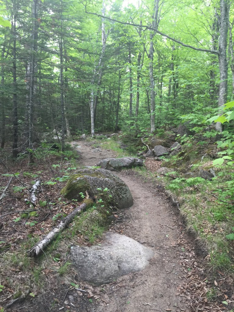
The trail begins…
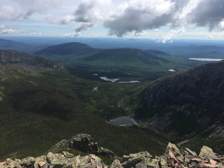
Beautiful little lakes were everywhere. Since the temperature was still cool, there were not really any mosquitos to accompany them!

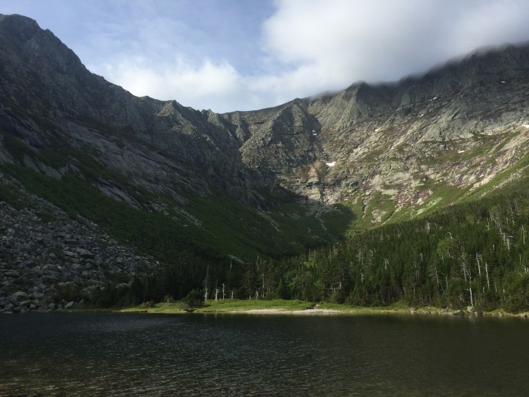
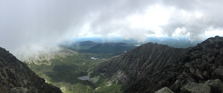
A view of Chimney Pond at the base of Katahdin, still somewhat veiled by clouds.
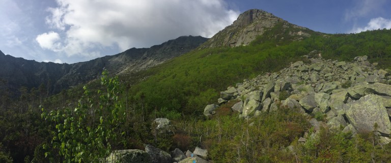
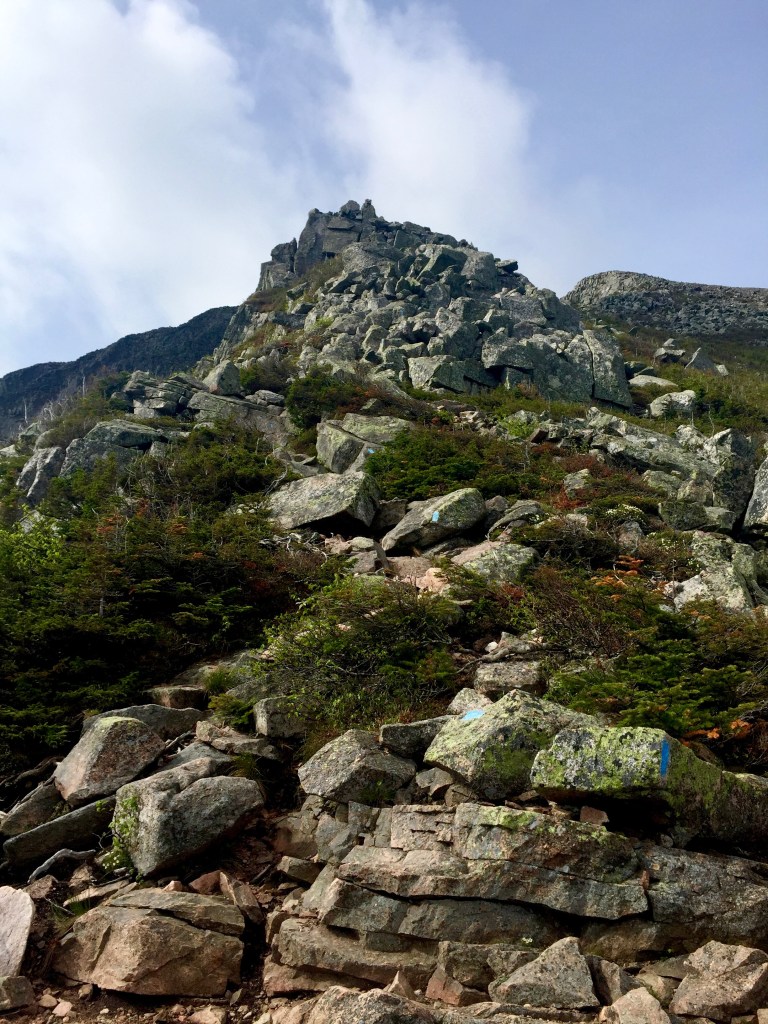
A view of the first Cathedral at the start of the Cathedral Trail. The trail goes right up the boulders to the right, which are each 8 to 10 feet high. The rating for the trail was class 3-4, meaning scrambling with occasional exposure.
Atop the first chimney.
Another one awaits…
Some views from the chimney.

Another scramble after the chimneys.
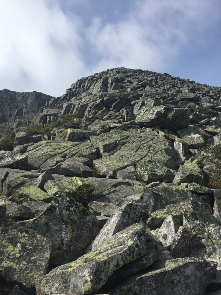
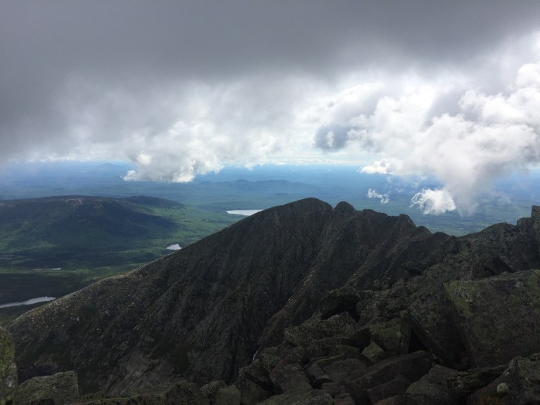
Some views of the surrounding area as elevation increased. Clouds were moving through periodically. I wasn’t sure how long they would last, so I raced the one in the picture below to the summit.

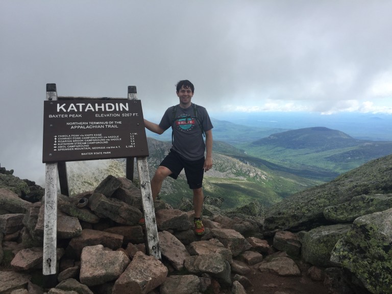
And I beat the cloud to the summit! Barely.
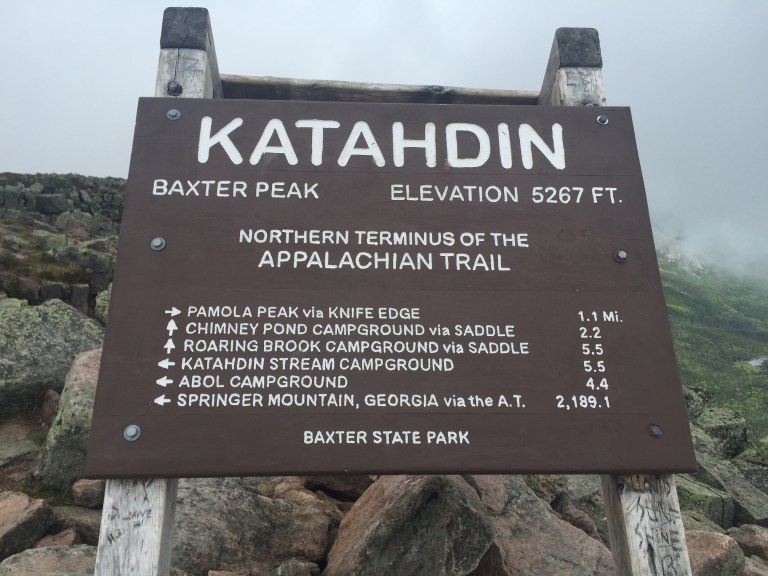
Only 2,189.1 miles away from Springer Mountain back in Georgia!
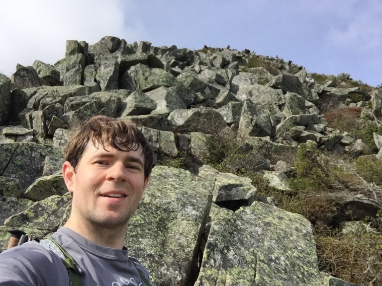
Enjoying the summit.

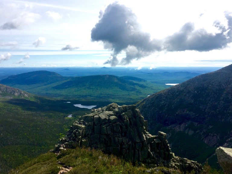
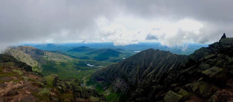
One of my favorite shots from the top. You can see the cairn marking the top to the right.
You aren’t finished until you get down, so I headed down the opposite way I came towards the knife edge.
Looking back at the summit where I just was.

A pano looking back.
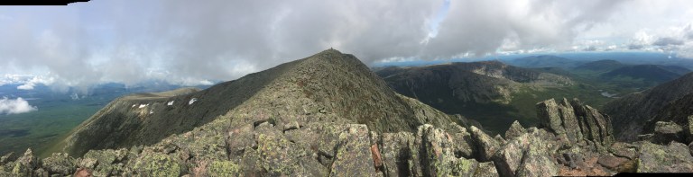
Looking towards Pamola Peak.
Up close and personal with Knife Edge.
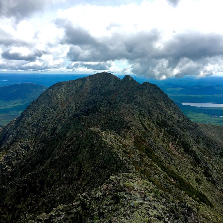
Looking back up knife edge towards the summit.
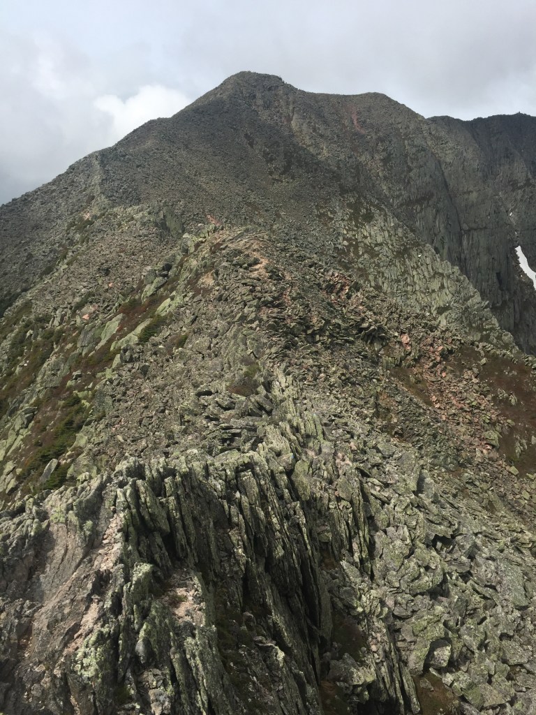
A feel for what scrambling on Knife Edge is like. Its steep and narrow. The little dots along the ridge (top left) are other hikers that are coming my direction.

Cathedral Trail took the approach of climbing straight up the steep side of the mountain. It was cool and windy and I loved it. The Helon Taylor Trail (post Knife Edge) took the opposite approach… a long slow descent down the saddle. I much preferred the former. Helon Taylor was apparently a beloved park ranger, but I think they did her wrong. I would rename the trail “Death By a Billion Mosquitos”. I am not joking. I was accosted the entire way down. I stopped to put on some bug spray, but still felt like the clouds of mosquitos would land anywhere I missed, particularly on my face or ears.
Because of their aggressiveness, I started to move very rapidly once below tree line. This resulted in a very near fall (would have been 2-3 feet but onto a bunch of rocks… not good). I managed to slide and swing my arms and legs and somehow land on my right foot several feet down. Yes! But in the process, I dragged my left foot into a big sharp rock. Since I was wearing trail running shoes with mesh tops, I had zero protection for my big toe, which was smashed and badly bruised under the nail. I’ll survive, but this unfortunately stopped me from being able to hike Mount Marcy in New York on Sunday. I guess my Sunday will be a day of rest.
