I started my day with a quick pass through the only breakfast place I could find in small town PA… McDonalds. After a quick sausage biscuit and coffee, I hit the trail at Mount Davis.
If I had to pick a word to summarize Mount Davis, it would be rain. If I had to pick a second and third, I would pick “rain” and “rain”. Somewhere down the road I would also add “green” to that list. Rain is no problem. I dawned my Columbia rain jacket and set out down the creek…err….trail.


Mount Davis sits at an elevation of 3,212 feet above sea level, but it has very little prominence from the surrounding area. There aren’t really any significant trail systems available, so I settled for the 2ish mile round trip to the summit. I kept to the high sides of the trail, hopped along whatever rocks were available, and tried to stay dry. Unfortunately I only brought trail running shoes for this trip and no boots, so my feet were getting pretty wet. No problem; I just cranked some AC in the car when I got back and was dry (enough) by the time I reached my next stop.


The Pennsylvania countryside is really pretty. I enjoyed driving around in the sunshine with the windows down. At least when it wasn’t raining. I also got my first look at the Amish in the form of several horse drawn carriages cruising down the back roads.
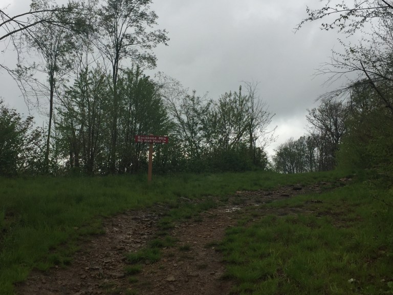
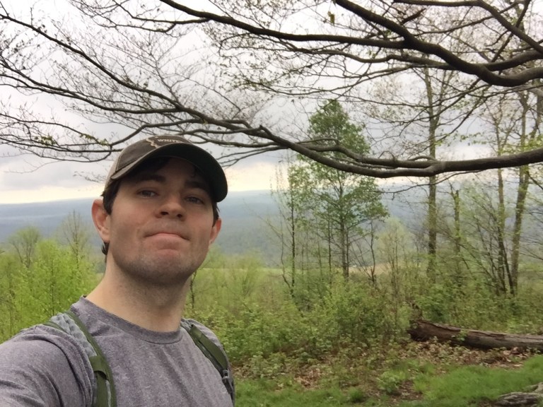
My next stop was Hoye Crest on Backbone Mountain, the highest point in the state of Maryland at 3,320 feet. Hoye Crest sits right along the Maryland/West Virginia state line. My wandering around the summit actually led me to find a state line marker placed in 1903. I nearly wiped out on some wet rocks, but fortunately was able to regain balance after a second and not collide with the ground.
The trail to Hoye seemed to be either an old logging road or perhaps fire road. There were a number of spurs that were blocked now with large rocks but that clearly used to serve as roads. My guess would be logging, which seems all too common in the nation’s forests. Logging is obviously necessary; we need wood to build things. It is a shame to lose some of the beautiful places we have in our country though. Even the summit of Hoye was clearly logged in the past. Numerous stumps were present, piled with rocks (for some unknown reason).
The view from Hoye Crest was nice. I spent a few minutes filling out the registry, snagged a certificate of visitation of the Maryland high point (nice touch Maryland guys!), and then headed back down. I could see a storm coming in the distance and started to hear some thunder, so I decided it was time to get back to the car.


On the way out, I made a quick stop by the smallest church in the lower 48 states.


My next step for the day was Spruce Knob, West Virgina which was my highest point on this trip: 4,862 feet. The drive was roughly 2 hours and was fantastic. West Virginia is known as the mountain state and I see why. There are a LOT of mountains. Where I was, there were no interstates around, no major roads, no cell phone service, and no restaurants or significant developments. Its in place were lots of winding backroads (that deteriorate quickly from paved to gravel to unpaved at times), trees and alpine meadows and exposed rock faces, and a chance to drive peacefully through the beauty and enjoy the day. The sky decided to turn to a brilliant blue and sun shined happily on a bright green spring day.
The high point itself was quite impressive. I generally like to hike a few miles to reach the summit, but I couldn’t figure out what trails to take to reach the summit, so I started at the top and then did a hike down a few miles and back on the Huckleberry Trail.


And of course, the summit.


The summit itself had decent views, but a short walk down led to some fantastic panoramas of the surrounding mountains.


It was quite windy, but a beautiful day. Fir trees were present in abundance. They have to be one of my favorites. Beautiful and they smell fantastic.
Reflecting on my high point experience to date (20/50), West Virginia easily makes the top 5 along with Colorado, Texas, New Hampshire, and Virginia. In fact, the ones I would most likely return to of the 5 would be Colorado and West Virgina. I would love to spend some more time there and definitely would camp at some of the excellent backcountry sites under the fir trees. Who is in?
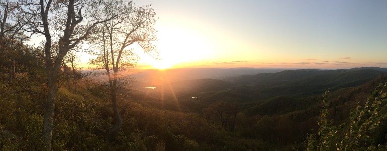
At this point, my trip was only about 18 hours in. I had already hit 4 state high points. Why not add one more stop? I decided to head over towards Shenandoah National Park where I was planning to hike the following day. I intended to do a sunset hike but failed to find the trail head, so I claimed a spot on a big rock a ways off the road and enjoyed the end of a fantastic day.